CUBE Chatshaala - Discusion Summary
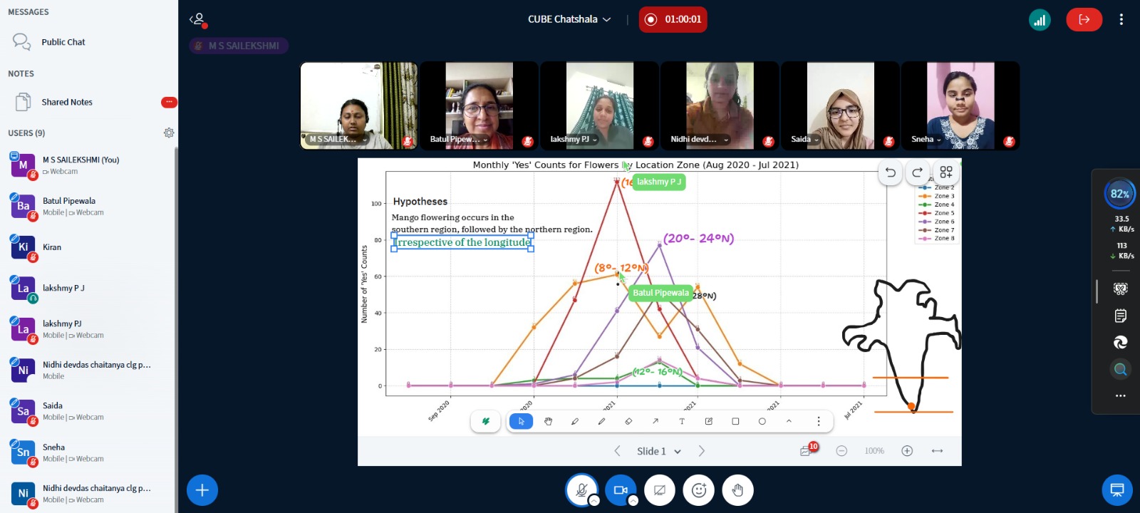
The discussion CUBE ChatShaala on 20 February 2026 The focus was on analyzing mango flowering data collected through citizen science efforts and uploaded to Kobo Toolbox. The discussion revolved around the latitudinal progression of flowering across India, supported by graphical representations spanning August 2020 to July 2021.
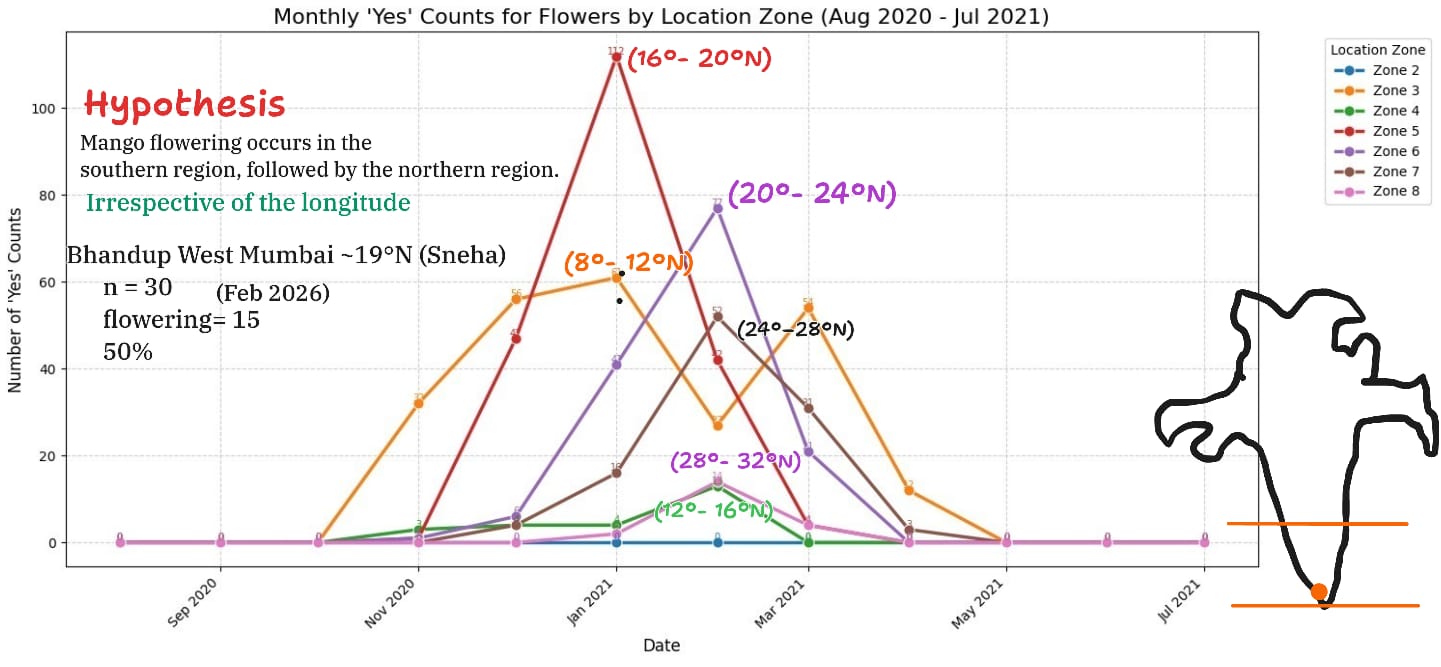
The dataset was broken down into zones:
- Zone 3 (8°–12°N, Thiruvananthapuram to Bengaluru) –
 Orange line
 - Zone 4 (12°–16°N, Bengaluru to Goa) –
 Green line
 - Zone 5 (16°–20°N, Goa to Mumbai) –
 Red line
 - Zone 6 (20°–24°N, Mumbai to Ahmedabad) –
 Purple line
 - Zone 7 (24°–28°N, Ahmedabad to Delhi) –
 Brown line
 - Zone 8 (28°–32°N, Delhi to Shimla) –
 Light pink line
The central hypothesis discussed was: Mango flowering begins in southern latitudes and gradually moves northward, irrespective of longitude. This was supported by the sequential rise in “Yes” counts across zones, with flowering first observed in Kerala and later in northern regions like Delhi and Shimla.
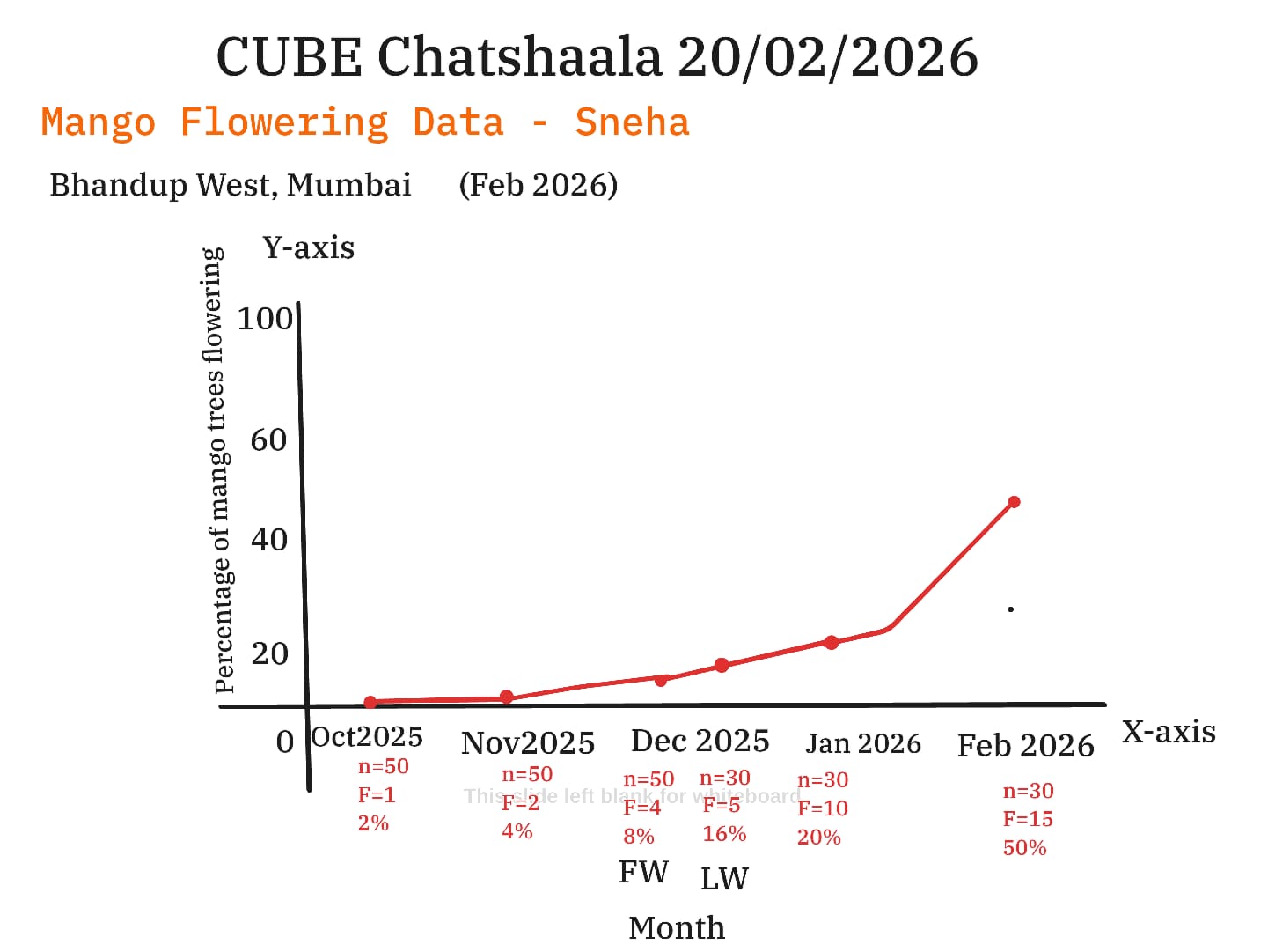
Cubists also reflected on Sneha’s localized dataset from Bhandup West, Mumbai (Oct 2025–Feb 2026), which showed flowering percentages rising from 2% in October to 50% in February. This micro-level observation aligned with the broader latitudinal trend.
The conversation drew connections to the IMD’s Mausam Journal article on phenological studies, emphasizing the importance of systematic, long-term data collection. The cubists recognized how citizen science observations can complement institutional records, strengthening the understanding of climate-driven phenological shifts.
 Provocative Questions
-
Could mango flowering patterns serve as a bio-indicator of climate change in India’s diverse ecosystems?
-
How might altitude interact with latitude to influence flowering timelines?
-
What role do urban microclimates (e.g., Mumbai’s heat island effect) play in altering phenological patterns?
-
How can citizen science data be standardized to ensure comparability across regions and years?
-
If longitude is not a factor, what other overlooked variables (soil type, rainfall distribution, photoperiod) might be significant?
-
Could mango flowering data be integrated into agricultural forecasting systems to guide farmers in crop management?
 What I Have Learned
-
Latitudinal progression is clear: Flowering begins in southern zones and moves northward, confirming the hypothesis.
-
Local data matters: Sneha’s Mumbai dataset illustrates how small-scale observations can validate larger trends.
-
Citizen science complements institutional research: Grassroots data collection enriches national records like those maintained by IMD.
-
Phenology is climate-sensitive: Flowering timelines are not just biological events but indicators of broader climatic shifts.
-
Sample size influences reliability: Larger datasets provide stronger confidence, highlighting the need for consistent participation.
 TINKE Moments (This I Never Knew Earlier)
-
Longitude irrelevance: The realization that longitude does not significantly affect flowering progression challenged initial assumptions.
-
Urban-rural contrasts: The idea that urban microclimates could skew flowering timelines was a fresh perspective.
-
Historical continuity: Discovering that IMD has maintained phenological records for decades underscored the importance of long-term monitoring.
-
Citizen science impact: Recognizing that local observations can meaningfully contribute to national-scale climate studies was eye-opening.
 Gaps and Misconceptions
-
Overemphasis on temperature: Many participants initially assumed temperature alone drives flowering, overlooking rainfall, soil, and photoperiod.
-
Sample size overlooked: Some discussions treated percentages as sufficient without considering the statistical weight of larger datasets.
-
Longitude confusion: Early debates suggested longitude mattered, but evidence clarified latitude as the dominant factor.
-
Data standardization challenge: Variability in observation methods across zones highlighted the need for more uniform protocols.