CUBE ChatShaala – 17 December 2025
Theme: Reading Latitude as a Living Variable, Not Just a Line on the Map
Meeting Summary
The ChatShaala session centered on a hand-drawn latitudinal map of India used as a thinking tool rather than a reference diagram. By plotting familiar cities—Trivandrum (8°N), Bangalore (12°N), Mumbai (18°N), Pamgarh (21°N), Kolkata (22°N), and Sapekhati (27°N)—participants collectively explored how latitude subtly but decisively shapes climate, seasonality, and biological rhythms.
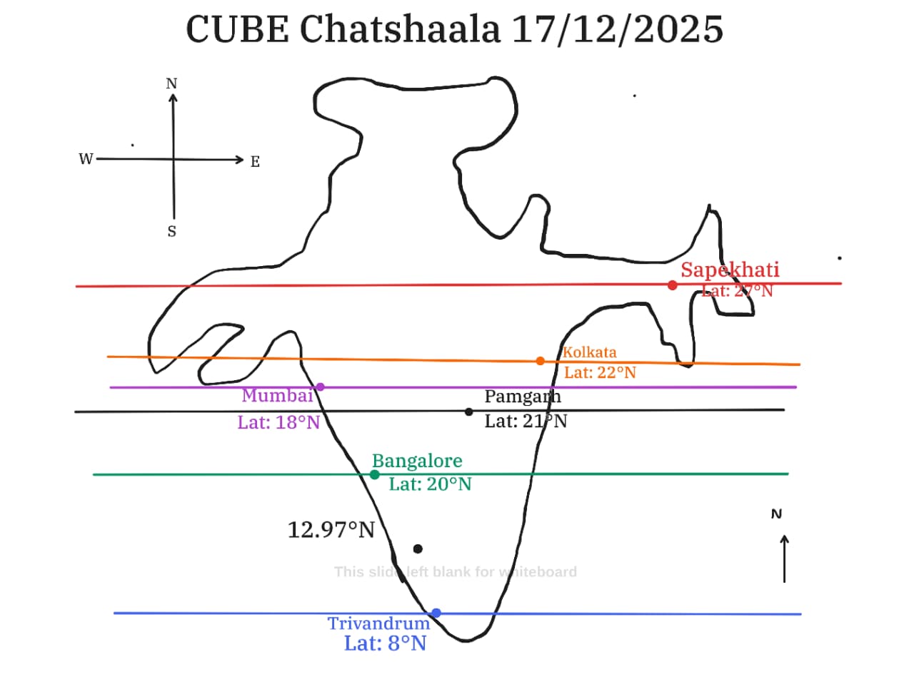
Instead of treating latitude as a static geographic coordinate, the discussion reframed it as an ecological gradient. Participants examined how small shifts north or south alter sunlight angle, day length, temperature regimes, and consequently, mango mapping phenology, flowering time, and growth patterns. The whiteboard discussion emphasized that India’s north–south extent compresses a wide range of climatic experiences into a relatively narrow longitudinal space, making it an ideal natural laboratory.
The session highlighted that patterns we often attribute vaguely to “climate” can be traced systematically to latitudinal position, interacting with local factors such as altitude and proximity to the sea. The map became a shared reference for reasoning, comparison, and hypothesis-building rather than memorization.
 Whiteboard-Based Provocative Questions
-
Why do flowering times, cycles, and even human comfort zones change predictably as we go from 8°N to 27°N?
-
What does ‘season’ mean when day length hardly changes versus when winter light shortens dramatically?
-
How many ecological Indias exist between Trivandrum and the northern plains, and do we consider them in our research?
-
Why do living systems respond nonlinearly to simple geographic gradients?
-
What patterns emerge from flowering in various Indian states that would otherwise be invisible without this lens?
 What I Have Learned
-
Latitude is not merely cartographic; it is ecological and temporal.
-
Small numerical differences (18°N vs 22°N) can correspond to meaningful biological changes.
-
India’s compact latitudinal range still captures a remarkable diversity of environmental conditions.
-
Visual mapping encourages hypothesis formation more effectively than textual descriptions alone.
-
Observations become richer when geographic position is treated as an active variable.
 TINKE Moments (Things I Never Knew Earlier)
-
Day length variation within India is sufficient to influence phenology, even without extreme seasons.
-
Cities often grouped together climatically (e.g., Mumbai and Kolkata) differ meaningfully when latitude is foregrounded.
-
Latitude interacts with local ecology, not in isolation but as part of a layered system.
-
Hand-drawn maps can provoke deeper reasoning than polished digital ones because they invite participation.
-
A single line on the map can unify discussions across biology, geography, and climate science.
 Gaps and Misconceptions
-
Misconception: Latitude affects only temperature.
Reality: It also governs light duration, angle, and seasonal rhythm. -
Misconception: Tropical regions are climatically uniform.
Reality: Tropical latitudes still show significant internal gradients. -
Gap: Limited attention to how latitude interacts with altitude and monsoon dynamics.
-
Gap: Tendency to memorize coordinates without linking them to lived ecological consequences.
-
Gap: Underuse of geographic reasoning in biological field observations.
 Photographs during Chatshaala
 photographs of Mango Flowering
* Sneha maurya - Bhandup West, Mumbai, Maharashtra
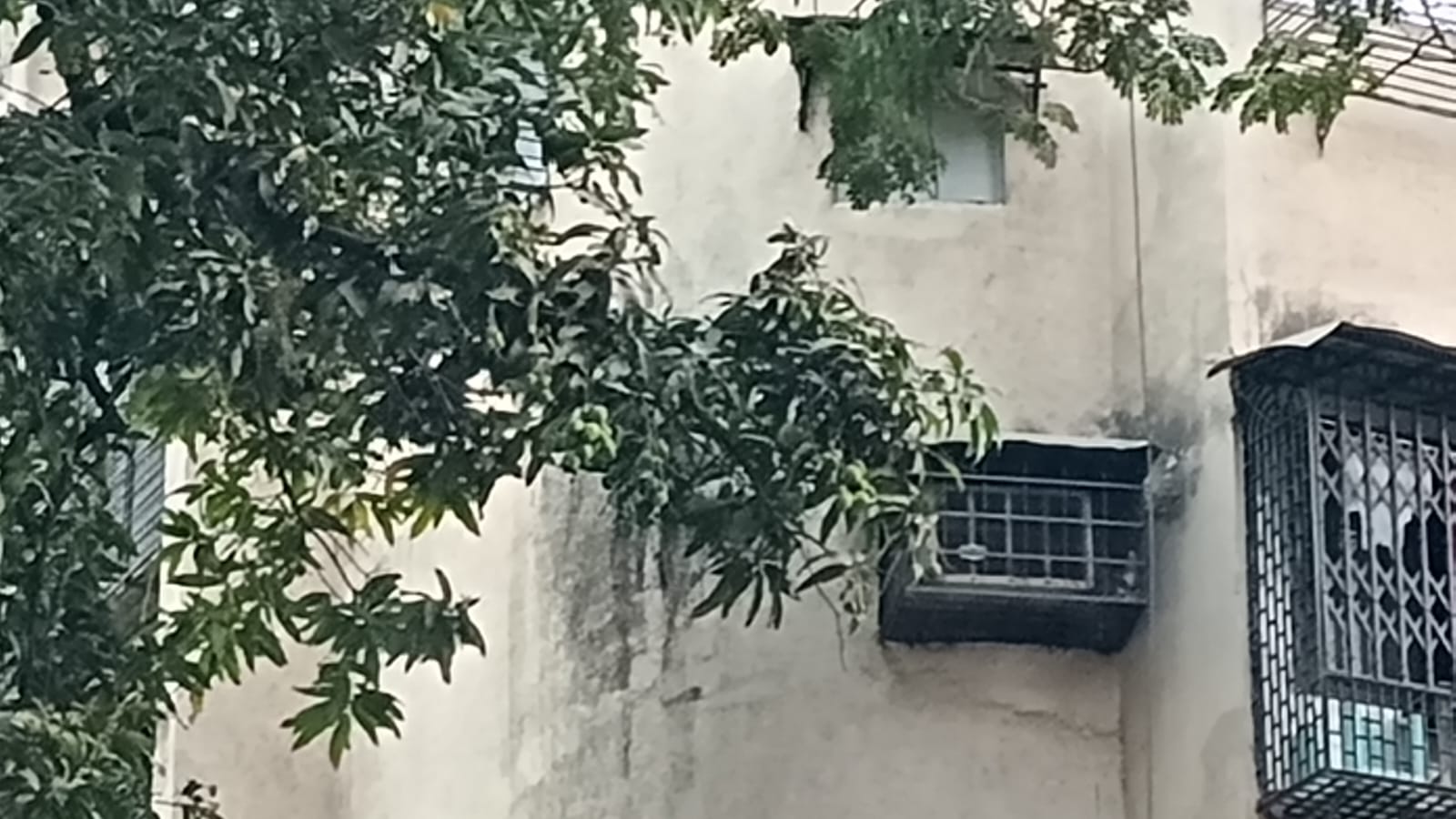
Photo taken on 1st Dec 2025 in Bhandup West, Mumbai.
* M S Sailekshmi - S N College, Chempazhanthy, Trivandrum, Kerala

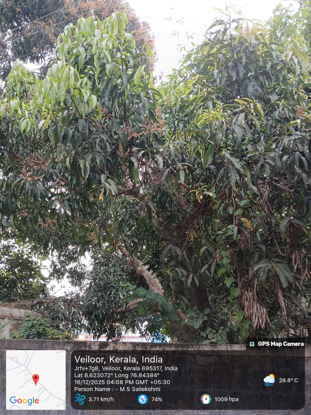
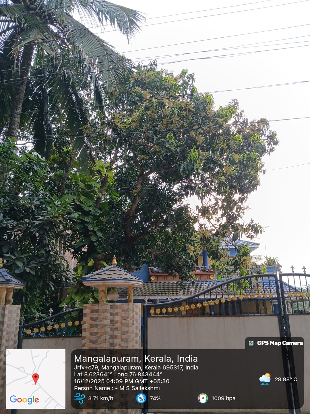
Yesterday, I observed 3 mango trees, and I noticed that 2 of them were flowering.
Name: M S Sailekshmi
Location: Velioor, Mangalapuram
Lat: 8.6°N
Long: 76.84°E